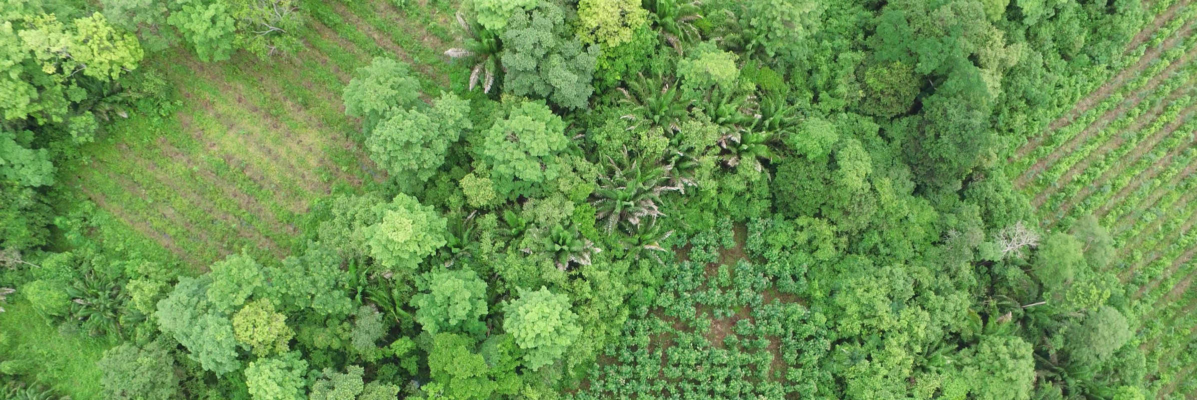
Drone view, river and green forest

WHAT WE DO

Earth Observation

Earth observation technology provides a new perspective to manage projects. By combining different data sources (from field measurements to satellites) and using machine learning and algorithms, we provide accurate and regular information for monitoring, reporting and verification (MRV) to our clients.

FORLIANCE’s cutting-edge geo-digital services enable investors, corporates and project developers to make more informed management decisions – based on precise and reliable data on project performance, developments, and environmental factors. In this way, productivity and efficiency may be increased while resource use and land consumption are minimized.

Let us help you!

Find out about the matching geo-digital solution for your project.

Contact our team

Data-driven solutions for forestry and agriculture

Forestry and especially agriculture have effects on ecosystems. For companies, minimizing the negative ramifications while at the same time maximizing productivity is the Holy Grail.

However, no project area is like any other. Different land types call for different protection and management actions (e.g. European forests differ from woods in the tropics). Diverging conditions may affect best practices (What is the weather like?; what plant grows best?); and environmental phenomena like floods or fires influence the ideal handling of a project area.

Topographical map

To account for these major differences and to reach the most efficient and effective management, data is a decisive factor. This data needs to be as accurate as possible. In this sense, we are here to support our clients with a vast array of modern digital technologies (mobile apps, sensors, drone and satellite images) for data collection.

While data collection is a first step, data processing and analysis come second: we use machine learning and algorithms to handle the data and follow up with the third step, the final product/map. These products support the user in deriving decisions, improving management actions, solving problems, reducing costs etc.

Within the area of Earth Observation, FORLIANCE therefore offers top-notch GIS and remote sensing services to improve strategic planning, management as well as communication of land use and forestry projects. Contact us now to learn more about our wide range of earth observation services.

OUR Services

GIS, Remote Sensing
and more

Geographic Information Systems (GIS) are spatial information systems which allow to capture, store, display and analyze geographically referenced data. GIS is a powerful tool supporting project developers not only in navigating and mapping their project site, but also in managing, evaluating and displaying the project geodata. This can serve as a good basis for informed decision-making and strategic planning.

FORLIANCE’s remote sensing services allow for a regular as well as time- and cost-efficient monitoring of all areas, including places that are difficult to access. Data collected via drone images can for instance be used for yield prognosis and value estimation, the detection of (potential) biomass and carbon storage, and also for marketing and communication means, providing impressive aerial images and videos.

What we offer in detail:

Mapping: We provide

  • Historical land use/land cover change
  • Deforestation analysis
  • Carbon sequestration
  • Forest inventory
  • Wildlife corridors and landscape fragmentation
  • Hydrological models

Moreover, we also look into the future and can model potential changes in the time to come.

Forest monitoring: We assist clients in assessing inventories of forests and other land use resources, modelling growth projections, and monitoring deforestation or harvesting activities. Monitoring can include the accounting for standing timber volume, calculation of carbon sequestration, biomass estimations, monitoring of growth and forest conditions, and assessments for rapid response to environmental impacts like fires or floods.

Use of LIDAR: This laser-based sensor makes it possible to acquire accurate information about an area regardless and despite of obstructing vegetation. FORLIANCE successfully uses the sensor in digital terrain models, plant counting, drainage maintenance and land use mapping, leading to reductions in costs and risks for our clients.

Precision agriculture: Satellite data and drone services deliver precise observations and measuring of crop growth and surrounding conditions. They allow for the optimization of agricultural processes such as

  • enhancing farm management
  • monitoring of crop health and productivity
  • optimizing the use of resources
  • identifying areas under water stress
  • providing early disease warnings.

Communication: Drone images offer emotion- and attention-grabbing communication regarding any type of land use and agriculture projects. This communication could for instance be directed at investors, consumers, or other stakeholders.

We also develop communication maps that enable our corporate clients to transparently communicate their project impact to external actors.

Topographical map

Our earth observation services – What are the benefits?

Our geo-digital services allow for the improvement of agricultural and forestry processes – such as scouting and selection of optimal project locations, enhancing productivity and efficiency, monitoring project performance (tree growth, crop health, etc.), optimizing the use of resources – and therefore enable more effective management decisions overall.


The precise and up-to-date data offers considerably faster information than traditional field-based evaluation. In comparison to traditional forest inventory techniques, our models have a higher level of detail and precision, and significantly reduced sampling and coverage errors. Moreover, they do not require a large inventory team and can easily be repeated. Thanks to verification/validation via crosschecking with other sources of information or historical data, numerous field visits to the respective site can be avoided.


The latter is of particular importance: Regular aerial monitoring delivers precise growth data of vegetation, thus allowing for an increase in productivity. Such monitoring also facilitates a rapid response to impacts.


Overall, the collection and analysis of historic data helps to understand the basic preconditions for a project, while modelling services enable the customer to learn about potential future developments in the project area.


Besides informed decision-making, our customers benefit from cost- and time-efficiency of drone data as compared to traditional forest inventory. For instance, work with the laser-based LIDAR sensor has resulted in reductions of up to 30% of time investment and around 70% of financial investment.


Another major benefit for customers relates to communications: Companies may refer to professionally developed “activity statements” by FORLIANCE in order to inform stakeholders, investors, press, NGOs etc. about their projects’ performance. Drawing on and referring to FORLIANCE a specialized, reliable, and professional service provider is a crucial communication asset.

Why FORLIANCE?

Our customers benefit from our technical expertise, our professional services, and the ensuing edge in corporate sustainability communication.


Through our worldwide network, we make sure that all client projects are advised by experts with in-depth understanding of the regional ecosystems, policies and management practices. With our consultants from a wide range of fields (agroforestry, forestry, finance, geography, IT, GIS), we offer agile but holistic solution-oriented approaches to all our clients.

Antonio Calle Forliance Staff

We look forward to hearing from you

Antonio Calle
Director Earth Observations

Insight

Reference Projects